


Drones 2024, 8(1), 21; https://doi.org/10.3390/drones8010021 - 15 Jan 2024
Abstract
The aim of producing self-driving drones has driven many researchers to automate various drone driving functions, such as take-off, navigation, and landing. However, despite the emergence of delivery as one of the most important uses of autonomous drones, there is still no automatic
[...] Read more.
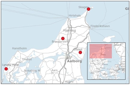
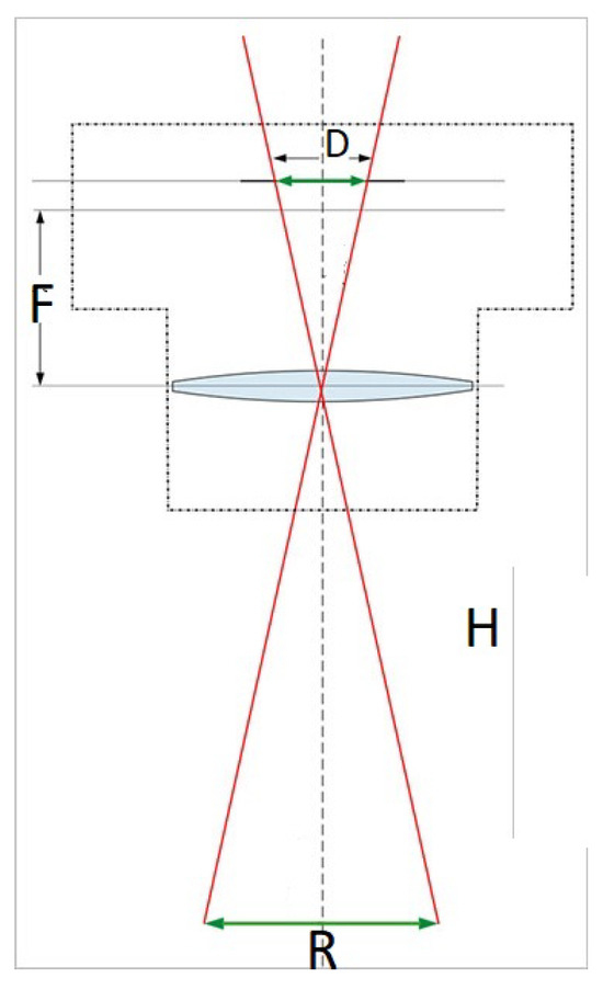
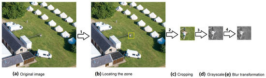
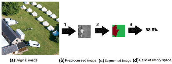
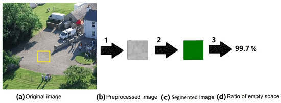
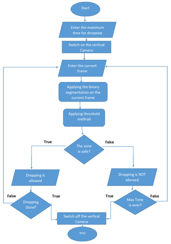
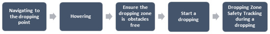
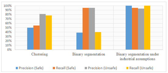
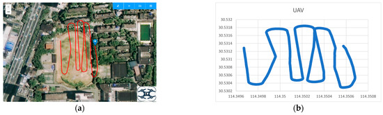
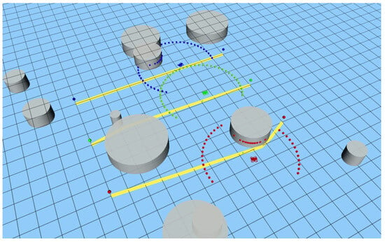
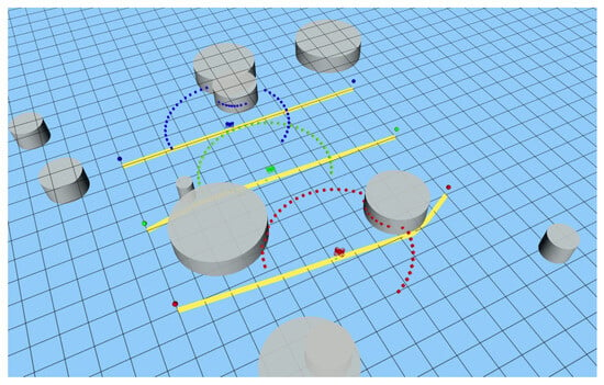
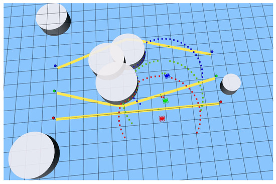
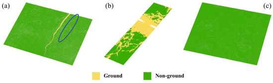
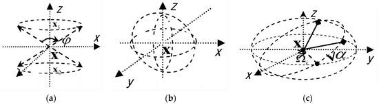
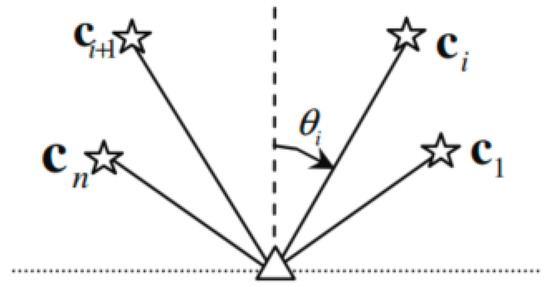
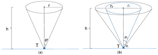
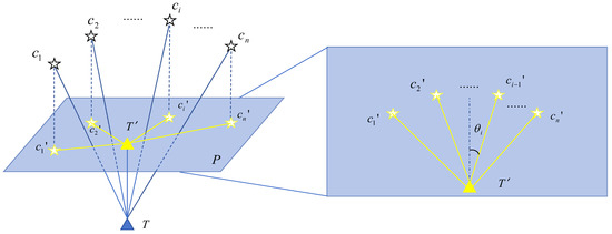
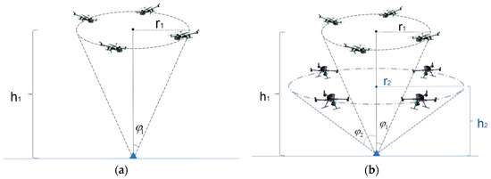
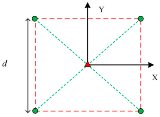
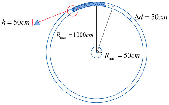
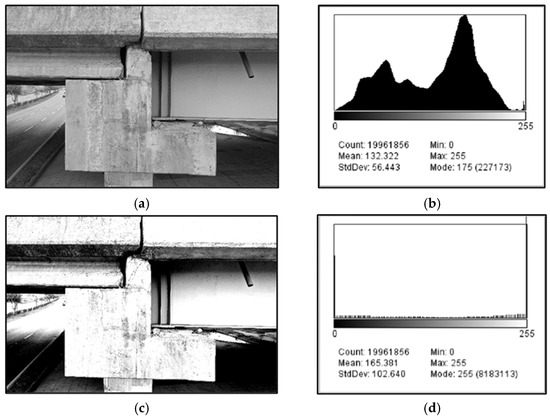
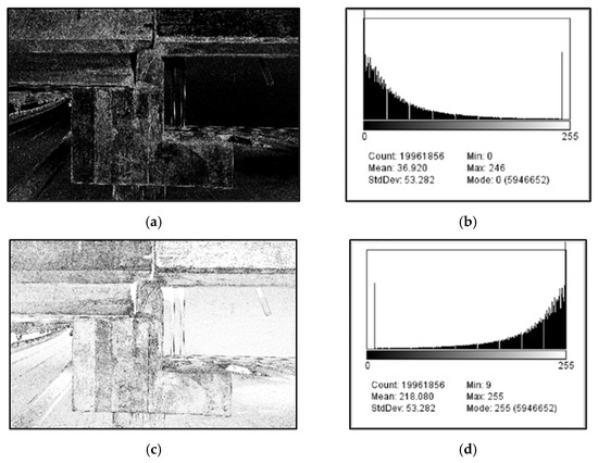
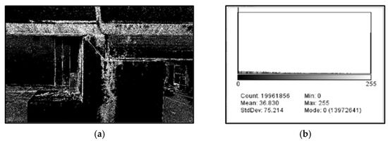
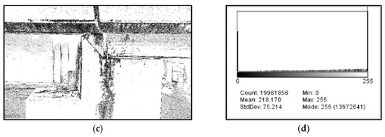
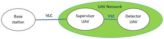
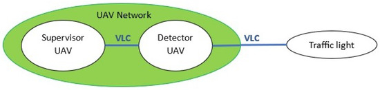
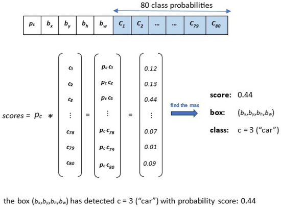
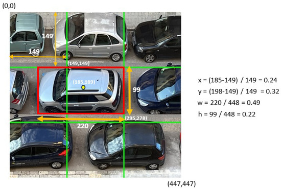
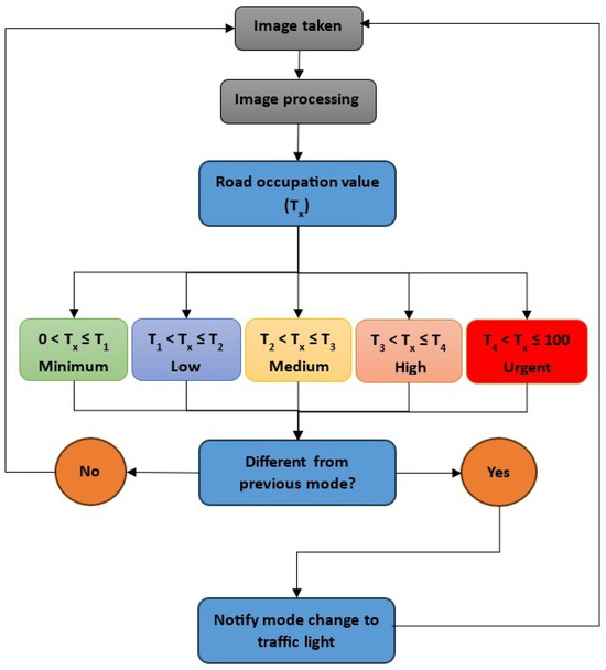
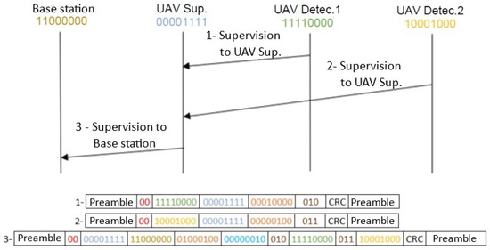
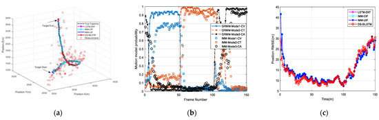
The aim of producing self-driving drones has driven many researchers to automate various drone driving functions, such as take-off, navigation, and landing. However, despite the emergence of delivery as one of the most important uses of autonomous drones, there is still no automatic way to verify the safety of the delivery stage. One of the primary steps in the delivery operation is to ensure that the dropping zone is a safe area on arrival and during the dropping process. This paper proposes an image-processing-based classification approach for the delivery drone dropping process at a predefined destination. It employs live streaming via a single onboard camera and Global Positioning System (GPS) information. A two-stage processing procedure is proposed based on image segmentation and classification. Relevant parameters such as camera parameters, light parameters, dropping zone dimensions, and drone height from the ground are taken into account in the classification. The experimental results indicate that the proposed approach provides a fast method with reliable accuracy based on low-order calculations.
Full article
(This article belongs to the Special Issue The Applications of Drones in Logistics 2nd Edition)
►
Show Figures
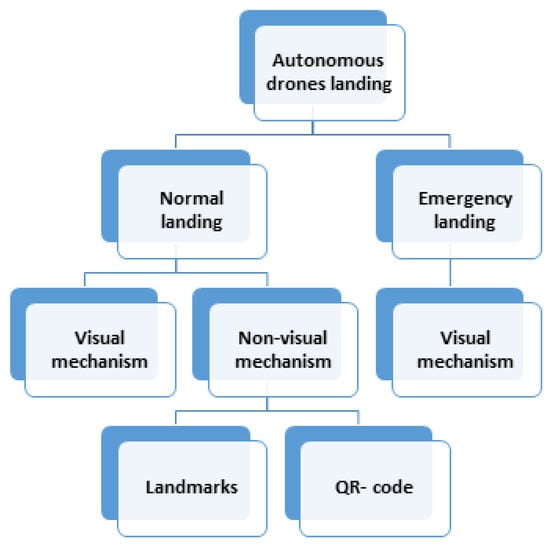
Figure 1


