


Earth 2024, 5(1), 1-19; https://doi.org/10.3390/earth5010001 - 25 Dec 2023
Abstract
►
Show Figures
Overburden rock massifs resulting from open-pit coal mining are very common objects in the world’s mining regions. These locations pose a significant challenge as the global mining industry expands. These dumps are capable of self-burning for quite a long time. The displacement and
[...] Read more.
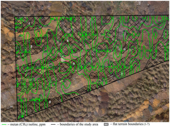
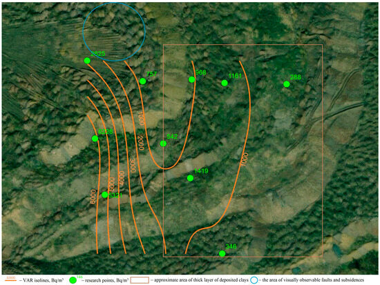
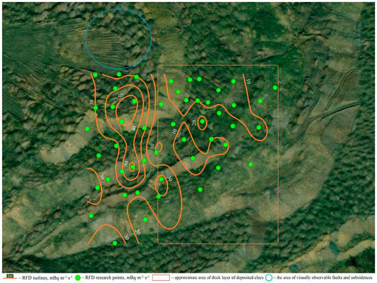
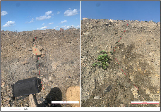
Overburden rock massifs resulting from open-pit coal mining are very common objects in the world’s mining regions. These locations pose a significant challenge as the global mining industry expands. These dumps are capable of self-burning for quite a long time. The displacement and sliding of these massifs can cause catastrophic consequences. In addition, these objects emit a significant amount of greenhouse gases into the atmosphere. Therefore, it is necessary to manage such objects and implement appropriate measures to limit their impact on the environment. In this work, we studied soil radon volume activity (VAR) and radon flux density (RFD) on the surface of the overburden rock massif of coal-bearing mining rocks and also made visual fixation of disturbances in the body of the massif, which appeared in the process of its movement. We found anomalies of VAR and RFD on the surface of the overburden extending from north to south. These anomalies were extended along the strike of the faults found in the body of the massif. Additionally, the radon anomalies coincided with the anomalies of methane gas emission previously measured for this object. Thus, we determined that the exit of gases from the body of the massif is carried out through fault (weakened) zones in the body of the massif. According to the results of the study, we propose to carry out radon monitoring in order to detect the spontaneous ignition process of the massif or the increase of its mobility. This will also allow us to take appropriate measures to stabilize the massif or to extinguish the dump before or simultaneously with the biological stage of reclamation.
Full article
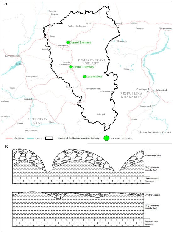
Figure 1


.jpeg)


