


Geosciences 2024, 14(1), 22; https://doi.org/10.3390/geosciences14010022 - 12 Jan 2024
Abstract
A spectral analysis of the time dynamics of seismicity occurring in the Enguri area of Georgia from 1978 to 2021 is performed by means of Schuster’s spectrum analysis, periodogram analysis, and empirical mode decomposition. The results of our analysis suggest that earthquakes around
[...] Read more.
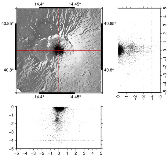
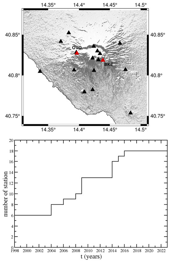
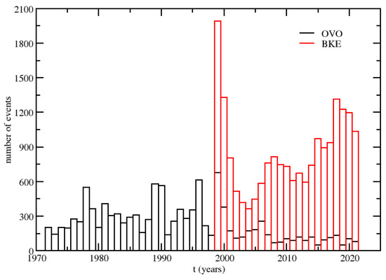
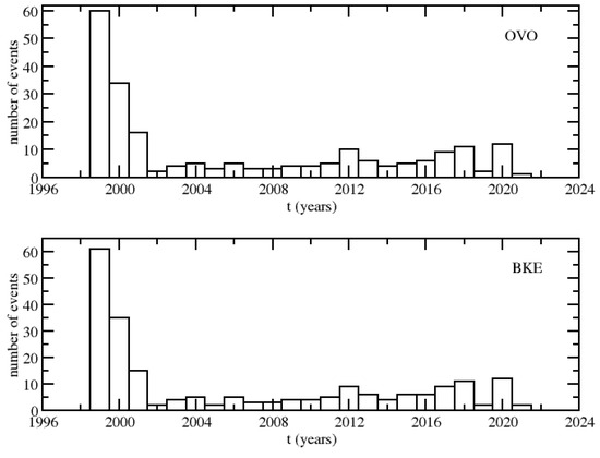
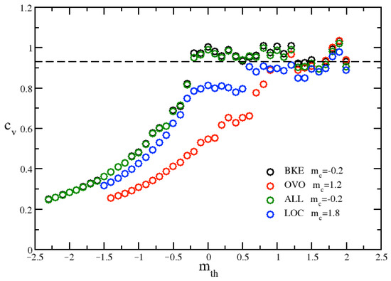
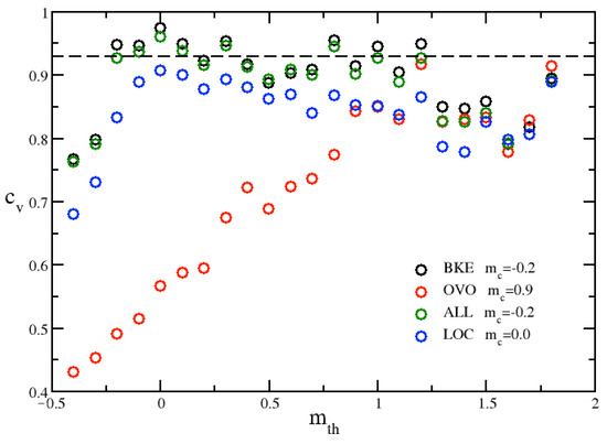
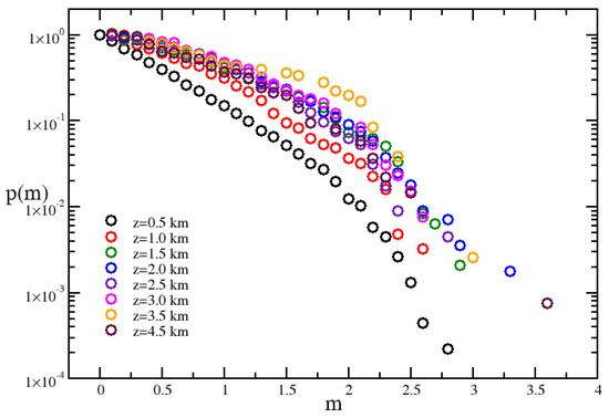
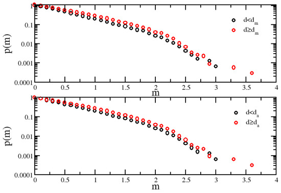
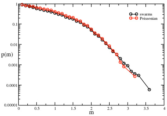
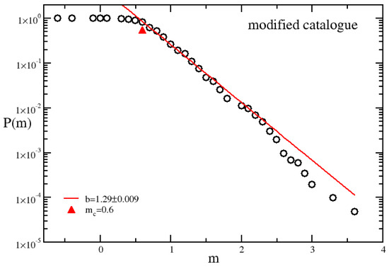
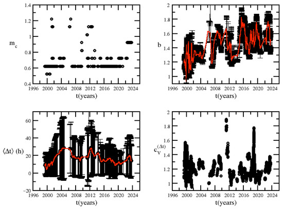
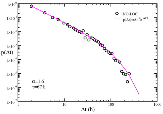
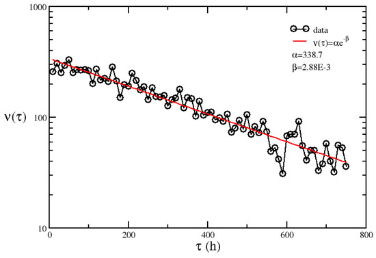
A spectral analysis of the time dynamics of seismicity occurring in the Enguri area of Georgia from 1978 to 2021 is performed by means of Schuster’s spectrum analysis, periodogram analysis, and empirical mode decomposition. The results of our analysis suggest that earthquakes around the reservoir (within a 50 km radius from the center of the dam) may be due to changes in water level, featured by the yearly cycle of loading and unloading operations of the reservoir. It is observed that the impacts of water fluctuations are more pronounced in shallower strata (down to 10 km) than deeper ones (down to 20 km); this could indicate that earthquakes occurring at deeper levels may primarily result from tectonic forces, whereas those at shallower depths may be predominantly triggered by reservoir-induced factors.
Full article
(This article belongs to the Section Natural Hazards)
►
Show Figures

Figure 1


.png)


.jpg)


