


Remote Sens. 2024, 16(2), 348; https://doi.org/10.3390/rs16020348 - 15 Jan 2024
Abstract
Quasi-continuous wave radar is an attempt to give consideration to the performance of pulse and continuous wave radar signals. However, it also has the shortcomings of both. This paper aims to add a new quasi-continuous-wave coding method to the spaceborne synthetic aperture radar
[...] Read more.
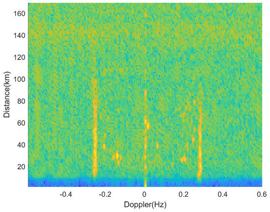
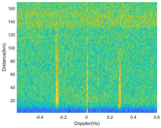
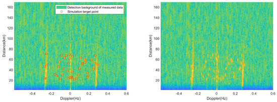
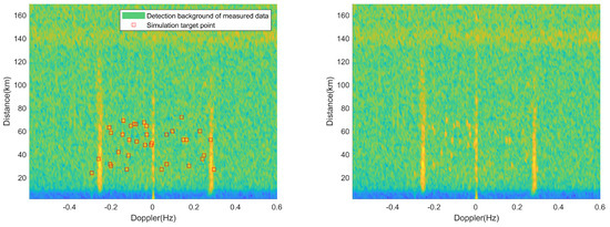
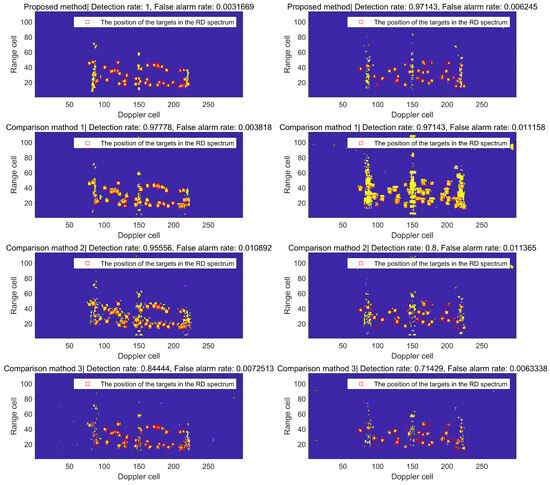
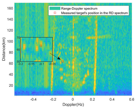
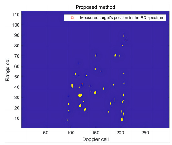
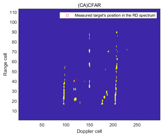
Quasi-continuous wave radar is an attempt to give consideration to the performance of pulse and continuous wave radar signals. However, it also has the shortcomings of both. This paper aims to add a new quasi-continuous-wave coding method to the spaceborne synthetic aperture radar (SAR) system. The technology of improving spaceborne SAR imaging performance by coding quasi-continuous-wave pulses is studied, and some shortcomings of this algorithm are improved. Firstly, the application of quasi-continuous-wave radar in the SAR system is studied, and the coding and reconstruction scheme is provided so that this technology can be successfully applied in spaceborne SAR. Secondly, the effects of different quasi-continuous-wave coding methods on SAR imaging performance are evaluated, including signal-to-noise ratio, resolution, and integration time. Then, several coding schemes are given, and the characteristic changes of the signal after quasi-continuous-wave coding are analyzed. The transmit–receive conversion loss function and azimuth Doppler ambiguity function of the design scheme are analyzed, which proves the advantages of the scheme. Finally, we design the hardware implementation scheme and carry out the practical test.
Full article
(This article belongs to the Section Engineering Remote Sensing)


